
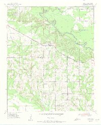
1951 Map of Garvin
USGS Topo · Published 1951About this map
The Little River meanders through the northern landscape of McCurtain County, creating distinctive landmarks like Possum Ford Bend and Rattlesnake Island. This mid-century topographical study shows a rural network of schoolhouses and churches that served the agricultural community, including Wheelock Academy in the northwest and Garvin at the intersection of the St Louis San Francisco railroad and U. S. Route 70. Numerous waterways, such as Waterhole Creek and Bokchito Creek, drain the territory, while the presence of the Forest Hill Ch Cem and several gravel pits indicates the local infrastructure and community hubs of the era. The map provides a clear picture of the township divisions, including the Sulphur, Kirk, and White districts, during a time when rural life was centered around these scattered points of interest.
Find a feature on this map
32 named features on this map. Tap any name to fly to it.
Don’t see what you’re looking for? This feature index may not catch every label — zoom into the map to look around manually.
Map Details
Editions of this 1951 Garvin Map
2 editions found
Other maps of this area

1901 · Alikchi
USGS Topo · 1:125,000

1902 · Lukfata
USGS Topo · 1:125,000

1950 · Mcalester
USGS Topo · 1:250,000

1950 · Idabel
USGS Topo · 1:24,000

1950 · Acworth
USGS Topo · 1:24,000

1951 · Idabel
USGS Topo · 1:24,000

1951 · Idabel SE
USGS Topo · 1:24,000

1951 · Acworth
USGS Topo · 1:24,000

1951 · Millerton
USGS Topo · 1:24,000

1951 · Negley
USGS Topo · 1:24,000