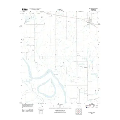
2012 Map of Millerton
USGS Topo · Published 2012About this map
Millerton anchors the northern landscape of this Oklahoma-Texas border region, with its grid of streets including Main St and Walnut St situated just south of the railroad line. The terrain transitions from the settled northern heights down to the complex alluvial environment of the Red River, which defines the southern boundary. This area is characterized by shifting watercourses and remnant features of river movement, such as the Horseshoe Bend Cutoff and several sloughs, including McKinsey Slough and Salt Well Slough.
Find a feature on this map
53 named features on this map. Tap any name to fly to it.
Don’t see what you’re looking for? This feature index may not catch every label — zoom into the map to look around manually.
Map Details
Editions of this 2012 Millerton Map
This is the sole edition of this map. No revisions or reprints were ever made.
Other maps of this area

1901 · Alikchi
USGS Topo · 1:125,000

1902 · Lukfata
USGS Topo · 1:125,000

1950 · Mcalester
USGS Topo · 1:250,000

1950 · Acworth
USGS Topo · 1:24,000

1951 · Garvin
USGS Topo · 1:24,000

1951 · Acworth
USGS Topo · 1:24,000

1951 · Millerton
USGS Topo · 1:24,000

1951 · Negley
USGS Topo · 1:24,000

1951 · Kiomatia
USGS Topo · 1:24,000

1951 · Manchester
USGS Topo · 1:24,000