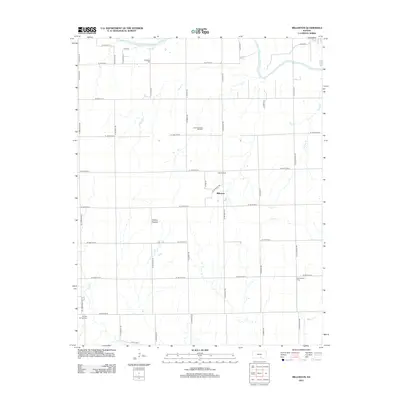
2012 Map of Millerton
USGS Topo · Published 2012About this map
The Ninnescah River flows through the northern reaches of this Kansas landscape, defining a terrain of agricultural grid lines and industrial activity. The small settlement of Millerton serves as a central point in an area where energy extraction is prominent, evidenced by the Latta Oil Field and Latta Northwest Oil Field. This survey captures a moment of modern land use within the Wichita Prairies, where the traditional rural structure of section-line roads meets contemporary industrial footprints. Genealogists will find several burial sites preserved across the township, including Harrington Cem in the north and Greencastle Cem to the southeast. The hydrology is dominated by the river and its tributaries, such as Turtle Cr, Silver Cr, and Slate Cr, which carve subtle paths through the flat prairie expanses.
Find a feature on this map
41 named features on this map. Tap any name to fly to it.
Don’t see what you’re looking for? This feature index may not catch every label — zoom into the map to look around manually.
Map Details
Editions of this 2012 Millerton Map
This is the sole edition of this map. No revisions or reprints were ever made.
Other maps of this area

1889 · Cheney
USGS Topo · 1:125,000

1889 · Wichita
USGS Topo · 1:125,000

1889 · Caldwell
USGS Topo · 1:125,000

1890 · Wellington
USGS Topo · 1:125,000

1891 · Cheney
USGS Topo · 1:125,000

1893 · Caldwell
USGS Topo · 1:125,000

1894 · Wichita
USGS Topo · 1:125,000

1897 · Caldwell
USGS Topo · 1:125,000

1901 · Cheney
USGS Topo · 1:125,000

1943 · Bayneville
USGS Topo · 1:31,680