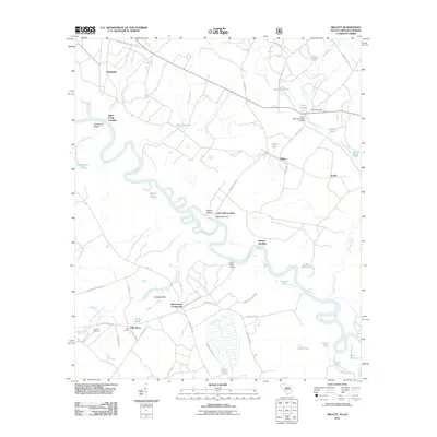
2011 Map of Millett
USGS Topo · Published 2011About this map
The Savannah River defines the western edge of this South Carolina landscape, its winding course giving rise to numerous oxbows and backwaters like Royal Lake, Queen Lake, and Cator Hall Lake. Small settlements and landing points dot the riverbanks and the interior road network, including Millett, Averill, and Hattieville. The map reveals a rural economy centered on the water, noted by the presence of Furse Mill Pond Dam D-2563 and several designated landings such as Steel Creek Landing and Browns Landing.
Find a feature on this map
68 named features on this map. Tap any name to fly to it.
Don’t see what you’re looking for? This feature index may not catch every label — zoom into the map to look around manually.
Map Details
Editions of this 2011 Millett Map
This is the sole edition of this map. No revisions or reprints were ever made.
Other maps of this area

1919 · Allendale
USGS Topo · 1:62,500

1920 · Ellenton
USGS Topo · 1:48,000

1920 · Hilltonia
USGS Topo · 1:62,500

1920 · Peeples
USGS Topo · 1:62,500

1921 · Ellenton
USGS Topo · 1:62,500

1943 · Allendale
USGS Topo · 1:62,500

1943 · Hilltonia
USGS Topo · 1:62,500

1943 · Peeples
USGS Topo · 1:62,500

1943 · Augusta East
USGS Topo · 1:125,000

1943 · Millen
USGS Topo · 1:125,000