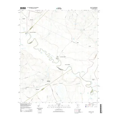
2014 Map of Millett
USGS Topo · Published 2014About this map
The Savanna River forms the winding border between South Carolina and Georgia in this 2014 survey, a landscape defined by riverside landings and expansive wetlands. Small settlements like Millett and Averill are situated along the eastern bank in Allendale County, while the river's path is marked by distinctive geographical features such as Devils Elbow and Little Hell Point. These names reflect the complex navigation of the river before modern stabilization. Further inland, the map identifies local landmarks that serve as vital connectors for the rural community, including Hills Store and the Rock Fence Crossroads. Genealogists may find particular value in the locations of Furse Cem and Corinth Cem, which are preserved alongside historic river access points like Steel Creek Landing and Browns Landing. The terrain is punctuated by numerous named bodies of water, such as Cator Hall Lake and Telfair Bay, illustrating the hydrologic character of the Savannah River basin.
Find a feature on this map
70 named features on this map. Tap any name to fly to it.
Don’t see what you’re looking for? This feature index may not catch every label — zoom into the map to look around manually.
Map Details
Editions of this 2014 Millett Map
This is the sole edition of this map. No revisions or reprints were ever made.
Other maps of this area

1919 · Allendale
USGS Topo · 1:62,500

1920 · Ellenton
USGS Topo · 1:48,000

1920 · Hilltonia
USGS Topo · 1:62,500

1920 · Peeples
USGS Topo · 1:62,500

1921 · Ellenton
USGS Topo · 1:62,500

1943 · Allendale
USGS Topo · 1:62,500

1943 · Hilltonia
USGS Topo · 1:62,500

1943 · Peeples
USGS Topo · 1:62,500

1943 · Augusta East
USGS Topo · 1:125,000

1943 · Millen
USGS Topo · 1:125,000