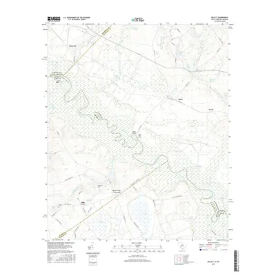
2017 Map of Millett
USGS Topo · Published 2017About this map
The Savannah River winds through this landscape, defining the state boundary between South Carolina and Georgia. Along its eastern banks, the communities of Millett and Averill anchor a rural region characterized by an intricate network of waterways and swampy lowlands. The terrain is marked by distinctive river features such as Devils Elbow, Little Hell Point, and the expansive Telfair Bay. These natural landmarks sit alongside long-standing local sites like Rock Fence Crossroads and the settlement at Hattieville.
Find a feature on this map
75 named features on this map. Tap any name to fly to it.
Don’t see what you’re looking for? This feature index may not catch every label — zoom into the map to look around manually.
Map Details
Editions of this 2017 Millett Map
This is the sole edition of this map. No revisions or reprints were ever made.
Other maps of this area

1919 · Allendale
USGS Topo · 1:62,500

1920 · Ellenton
USGS Topo · 1:48,000

1920 · Hilltonia
USGS Topo · 1:62,500

1920 · Peeples
USGS Topo · 1:62,500

1921 · Ellenton
USGS Topo · 1:62,500

1943 · Allendale
USGS Topo · 1:62,500

1943 · Hilltonia
USGS Topo · 1:62,500

1943 · Peeples
USGS Topo · 1:62,500

1943 · Augusta East
USGS Topo · 1:125,000

1943 · Millen
USGS Topo · 1:125,000