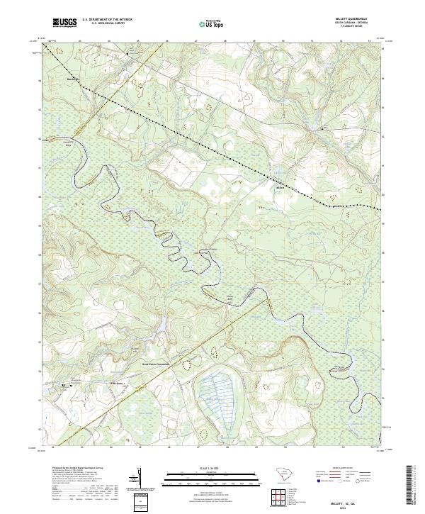
2024 Map of Millett
USGS Topo · Published 2024About this map
The Savannah River forms the winding boundary between South Carolina and Georgia, anchoring a landscape defined by extensive wetlands and historic river crossings. Small communities and landmarks like Millett, Averill, and Hattieville are situated along the terrace above the floodplain, connected by a network of rural roads such as Brigham Landing Rd and Stony Bluff Rd. The presence of the Stoney Bluff Ferry and the Rock Fence Crossroads indicates the enduring importance of river-access points and local junctions in this agrarian region.
Find a feature on this map
87 named features on this map. Tap any name to fly to it.
Don’t see what you’re looking for? This feature index may not catch every label — zoom into the map to look around manually.
Map Details
Editions of this 2024 Millett Map
This is the sole edition of this map. No revisions or reprints were ever made.
Other maps of this area

1919 · Allendale
USGS Topo · 1:62,500

1920 · Ellenton
USGS Topo · 1:48,000

1920 · Hilltonia
USGS Topo · 1:62,500

1920 · Peeples
USGS Topo · 1:62,500

1921 · Ellenton
USGS Topo · 1:62,500

1943 · Allendale
USGS Topo · 1:62,500

1943 · Hilltonia
USGS Topo · 1:62,500

1943 · Peeples
USGS Topo · 1:62,500

1943 · Augusta East
USGS Topo · 1:125,000

1943 · Millen
USGS Topo · 1:125,000