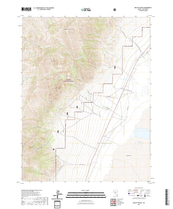
2021 Map of Millett Ranch
USGS Topo · Published 2021About this map
San Juan Cr flows through the high elevations of the Toiyabe Range, marking a landscape defined by dramatic relief and remote high-country drainage. This 2021 survey of the Millett Ranch area illustrates the stark transition from the steep, contoured slopes of the Toiyabe National Forest down into the broad expanse of the Big Smoky Valley. The map documents modern land management and road classifications within Nye County, showing the intersection of forest service lands and the valley floor. Researchers can trace the hydrography of small mountain streams as they emerge from the range and dissipate into the valley’s alluvial fans and alkali flats.
Find a feature on this map
1 named feature on this map. Tap any name to fly to it.
Don’t see what you’re looking for? This feature index may not catch every label — zoom into the map to look around manually.
Map Details
Editions of this 2021 Millett Ranch Map
This is the sole edition of this map. No revisions or reprints were ever made.
Other maps of this area

1907 · Tonopah
USGS Topo · 1:250,000

1908 · Tonopah
USGS Topo · 1:250,000

1955 · Millett
USGS Topo · 1:250,000

1956 · North Shoshone Peak
USGS Topo · 1:62,500

1956 · Millett Ranch
USGS Topo · 1:62,500

1956 · Tonopah
USGS Topo · 1:250,000

1959 · Tonopah
USGS Topo · 1:250,000

1959 · Millett
USGS Topo · 1:250,000

1962 · Tonopah
USGS Topo · 1:250,000

1971 · Carvers NW
USGS Topo · 1:24,000