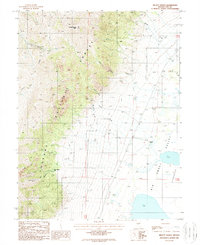
1988 Map of Millett Ranch
USGS Topo · Published 1988About this map
Millett Ranch and other family holdings define the western edge of the Big Smoky Valley in this late-twentieth-century study of Nye County. The map documents the sharp transition from the arid floor of the Big Smoky Depression, marked by features like Salt 5442 and Alkali Flat, to the steep elevations of the Toiyabe Range. This dramatic change in relief is underscored by the numerous drainage systems flowing eastward, including Alice Gendron Creek, Decker Bob Creek, and McLeod Creek.
Find a feature on this map
32 named features on this map. Tap any name to fly to it.
Don’t see what you’re looking for? This feature index may not catch every label — zoom into the map to look around manually.
Map Details
Editions of this 1988 Millett Ranch Map
This is the sole edition of this map. No revisions or reprints were ever made.
Other maps of this area

1907 · Tonopah
USGS Topo · 1:250,000

1908 · Tonopah
USGS Topo · 1:250,000

1955 · Millett
USGS Topo · 1:250,000

1956 · North Shoshone Peak
USGS Topo · 1:62,500

1956 · Millett Ranch
USGS Topo · 1:62,500

1956 · Tonopah
USGS Topo · 1:250,000

1959 · Tonopah
USGS Topo · 1:250,000

1959 · Millett
USGS Topo · 1:250,000

1962 · Tonopah
USGS Topo · 1:250,000

1971 · Carvers NW
USGS Topo · 1:24,000