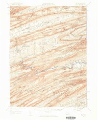
1957 Map of Millheim
USGS Topo · Published 1959About this map
Millheim and Aaronsburg serve as the primary valley settlements in this 1957 revision, situated within a landscape defined by the parallel ridges of Nittany Mountain and Brush Mountain. The terrain is marked by numerous gaps, such as Schroyer Gap and Kreamer Gap, which historically dictated the flow of travel through the Sugar Valley. The Lewisburg and Tyrone RR follows the winding path of Penns Creek, connecting isolated locations like Ingleby and Weikert. This corridor illustrates the region's reliance on river-level routes for heavy transport through the Seven Mountains. To the east, the Joyce Kilmer Monument and the Snyder-Middleswarth State Forest Park signify the preservation of the Central Pennsylvania timberlands, while local landmarks like Woodward Cave and the Airway Beacon provide specific points of interest for local history researchers.
Find a feature on this map
106 named features on this map. Tap any name to fly to it.
Don’t see what you’re looking for? This feature index may not catch every label — zoom into the map to look around manually.
Map Details
Editions of this 1957 Millheim Map
Other maps of this area

1907 · Millerstown
USGS Topo · 1:62,500

1921 · Howard
USGS Topo · 1:48,000

1921 · Williamsport
USGS Topo · 1:48,000

1921 · Lock Haven
USGS Topo · 1:62,500

1923 · Howard
USGS Topo · 1:62,500

1923 · Lock Haven
USGS Topo · 1:62,500

1923 · Williamsport
USGS Topo · 1:62,500

1924 · Centre Hall
USGS Topo · 1:62,500

1924 · Lewistown
USGS Topo · 1:62,500

1925 · Mifflintown
USGS Topo · 1:48,000