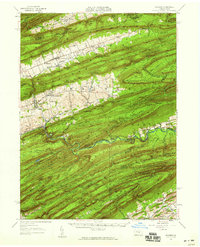
1957 Map of Millheim
USGS Topo · Published 1959About this map
Millheim and the surrounding Ridge-and-Valley Appalachians appear here in a mid-century topography that highlights the region's dense network of narrow valleys and high ridges. The map captures the agricultural patterns in Sugar Valley and Brush Valley, where settlements like Rebersburg and Aaronsburg are connected by roads following the valley floors. In contrast, the high ground of Nittany Mountain and Thick Mountain remains largely undeveloped, defined by geological features such as The Winehead and numerous gaps like Rockville Gap and Schroyer Gap.
Find a feature on this map
131 named features on this map. Tap any name to fly to it.
Don’t see what you’re looking for? This feature index may not catch every label — zoom into the map to look around manually.
Map Details
Editions of this 1957 Millheim Map
Other maps of this area

1907 · Millerstown
USGS Topo · 1:62,500

1921 · Howard
USGS Topo · 1:48,000

1921 · Williamsport
USGS Topo · 1:48,000

1921 · Lock Haven
USGS Topo · 1:62,500

1923 · Howard
USGS Topo · 1:62,500

1923 · Lock Haven
USGS Topo · 1:62,500

1923 · Williamsport
USGS Topo · 1:62,500

1924 · Centre Hall
USGS Topo · 1:62,500

1924 · Lewistown
USGS Topo · 1:62,500

1925 · Mifflintown
USGS Topo · 1:48,000