
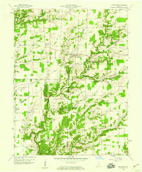
1958 Map of Millhousen
USGS Topo · Published 1959About this map
The community of Millhousen anchors this rural landscape at the crossroads of Decatur and Ripley counties in the late 1950s. The region is defined by a dense network of watercourses, including the Vernon Fork, Cobbs Fork, and Flatrock Creek, which carve through the terrain. Evidence of the area's mid-century energy production is visible in the numerous Gas Wells scattered across the Gas Field in Marion Township, supported by several Pipelines and a central Pumping Station.
Find a feature on this map
29 named features on this map. Tap any name to fly to it.
Don’t see what you’re looking for? This feature index may not catch every label — zoom into the map to look around manually.
Map Details
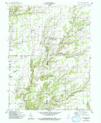
Editions of this 1958 Millhousen Map
3 editions found
Other maps of this area

1942 · Columbus
USGS Topo · 1:125,000

1946 · Versailles
USGS Topo · 1:24,000

1946 · Osgood
USGS Topo · 1:24,000

1946 · New Point
USGS Topo · 1:24,000

1953 · Cincinnati
USGS Topo · 1:250,000

1957 · Cincinnati
USGS Topo · 1:250,000

1957 · Butlerville
USGS Topo · 1:24,000

1958 · Greensburg
USGS Topo · 1:24,000

1958 · Westport
USGS Topo · 1:24,000

1958 · Forest Hill
USGS Topo · 1:24,000