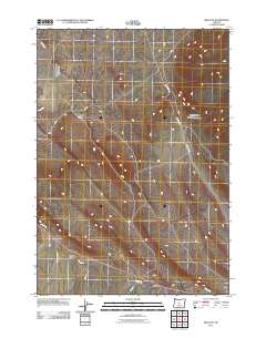
2011 Map of Millican
USGS Topo · Published 2011About this map
Millican stands as a primary point of reference in this high desert landscape, situated along the path of the ephemeral Dry River. The terrain is defined by dramatic drainage patterns and erosional features such as Smith Canyon and Tepee Draw, which carve through the open country. This 2011 survey by the U.S. Geological Survey illustrates a network of backroads and trails, including Spencer Wells Rd and Ford Rd, that crisscross the region's sparse vegetation and arid flats. The map serves as a record of rural Deschutes County infrastructure, showing the alignment of Millican Rd and Fox Butte Rd as they navigate the basin, providing critical waypoints for those navigating the wide-open spaces of central Oregon.
Find a feature on this map
13 named features on this map. Tap any name to fly to it.
Don’t see what you’re looking for? This feature index may not catch every label — zoom into the map to look around manually.
Map Details
Editions of this 2011 Millican Map
This is the sole edition of this map. No revisions or reprints were ever made.
Other maps of this area

1926 · Bend
USGS Topo · 1:125,000

1929 · Bend
USGS Topo · 1:125,000

1931 · Newberry Crater
USGS Topo · 1:125,000

1935 · Newberry Crater
USGS Topo · 1:125,000

1955 · Crescent
USGS Topo · 1:250,000

1955 · Bend
USGS Topo · 1:250,000

1957 · Crescent
USGS Topo · 1:250,000

1957 · Bend
USGS Topo · 1:250,000

1958 · Crescent
USGS Topo · 1:250,000

1958 · Bend
USGS Topo · 1:250,000