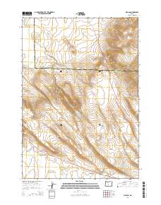
2014 Map of Millican
USGS Topo · Published 2014About this map
Millican sits at the southern edge of this Central Oregon high desert landscape, positioned where Us-20 intersects with the local road network. The terrain is defined by dramatic volcanic features and seasonal watercourses, most notably the winding path of the Dry River which cuts through the Millican Valley. Rising above the valley floor are significant landmarks including West Butte to the northeast and the Bear Creek Buttes further south.
Find a feature on this map
17 named features on this map. Tap any name to fly to it.
Don’t see what you’re looking for? This feature index may not catch every label — zoom into the map to look around manually.
Map Details
Editions of this 2014 Millican Map
This is the sole edition of this map. No revisions or reprints were ever made.
Other maps of this area

1926 · Bend
USGS Topo · 1:125,000

1929 · Bend
USGS Topo · 1:125,000

1931 · Newberry Crater
USGS Topo · 1:125,000

1935 · Newberry Crater
USGS Topo · 1:125,000

1955 · Crescent
USGS Topo · 1:250,000

1955 · Bend
USGS Topo · 1:250,000

1957 · Crescent
USGS Topo · 1:250,000

1957 · Bend
USGS Topo · 1:250,000

1958 · Crescent
USGS Topo · 1:250,000

1958 · Bend
USGS Topo · 1:250,000