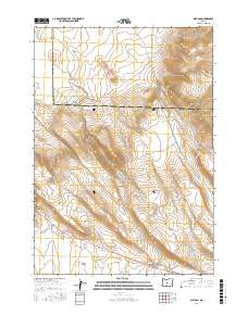
2017 Map of Millican
USGS Topo · Published 2017About this map
Millican Valley dominates this high-desert landscape along the border of Deschutes and Crook Counties. The settlement of Millican sits at a strategic junction in the south-central portion of the quadrangle, serving as a hub for the network of rural routes that cross this arid terrain, including Pine Mtn Rd, Ft Rock Rd, and Spencer Wells Rd. The geology is defined by volcanic features and ancient drainages, most notably the prominent Bear Creek Buttes and the winding course of the Dry River. To the north and west, the elevation shifts significantly toward West Butte and through Smith Canyon, while Tepee Draw cuts into the southern hills. This 2017 topographic survey highlights the sparse but vital human footprint across the sagebrush and juniper country, showing the enduring ranching and transit corridors of Central Oregon.
Find a feature on this map
20 named features on this map. Tap any name to fly to it.
Don’t see what you’re looking for? This feature index may not catch every label — zoom into the map to look around manually.
Map Details
Editions of this 2017 Millican Map
This is the sole edition of this map. No revisions or reprints were ever made.
Other maps of this area

1926 · Bend
USGS Topo · 1:125,000

1929 · Bend
USGS Topo · 1:125,000

1931 · Newberry Crater
USGS Topo · 1:125,000

1935 · Newberry Crater
USGS Topo · 1:125,000

1955 · Crescent
USGS Topo · 1:250,000

1955 · Bend
USGS Topo · 1:250,000

1957 · Crescent
USGS Topo · 1:250,000

1957 · Bend
USGS Topo · 1:250,000

1958 · Crescent
USGS Topo · 1:250,000

1958 · Bend
USGS Topo · 1:250,000