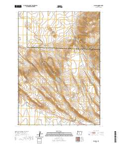
2020 Map of Millican
USGS Topo · Published 2020About this map
Millican sits at the southern edge of this Central Oregon survey, positioned along a network of high-desert roads including Pine Mtn Rd and Ft Rock Rd. The landscape is dominated by the volcanic forms of the Bear Creek Buttes and the prominent West Butte, which rises sharply near the Crook County and Deschutes County line. The wide Millican Valley extends across the lower portion of the map, intersected by the seasonal channel of Dry River, which cuts through the arid terrain. To the north, the topography is defined by the gradual descent of Smith Canyon and the corridor of Millican Rd. This 2020 update reflects the modern road network, including Powerline Acc and Spencer Wells Rd, documenting the contemporary state of this sparsely populated transition zone between the high desert and the foothills.
Find a feature on this map
21 named features on this map. Tap any name to fly to it.
Don’t see what you’re looking for? This feature index may not catch every label — zoom into the map to look around manually.
Map Details
Editions of this 2020 Millican Map
This is the sole edition of this map. No revisions or reprints were ever made.
Other maps of this area

1926 · Bend
USGS Topo · 1:125,000

1929 · Bend
USGS Topo · 1:125,000

1931 · Newberry Crater
USGS Topo · 1:125,000

1935 · Newberry Crater
USGS Topo · 1:125,000

1955 · Crescent
USGS Topo · 1:250,000

1955 · Bend
USGS Topo · 1:250,000

1957 · Crescent
USGS Topo · 1:250,000

1957 · Bend
USGS Topo · 1:250,000

1958 · Crescent
USGS Topo · 1:250,000

1958 · Bend
USGS Topo · 1:250,000