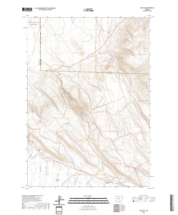
2024 Map of Millican
USGS Topo · Published 2024About this map
Millican sits at a critical junction of high desert travel, where the historic Millican Rd and Ft Rock Rd intersect within the wide Millican Valley. This 2024 survey captures a landscape defined by its arid drainage systems, including the long course of Dry River and several distinct geological depressions such as Tepee Draw and Wacam Draw. The northern portion of the map is dominated by the protected basalt and sagebrush terrain of the Oregon Badlands Wilderness, while the southern and eastern horizons are anchored by the prominent elevations of Bear Creek Buttes and West Butte. The intricate network of modern trails, such as the North Millican Tr 74 Trl and Millican Plateau Tr12 Trl, illustrates the area's contemporary role as a hub for backcountry navigation and recreation within the High Desert region.
Find a feature on this map
40 named features on this map. Tap any name to fly to it.
Don’t see what you’re looking for? This feature index may not catch every label — zoom into the map to look around manually.
Map Details
Editions of this 2024 Millican Map
This is the sole edition of this map. No revisions or reprints were ever made.
Other maps of this area

1926 · Bend
USGS Topo · 1:125,000

1929 · Bend
USGS Topo · 1:125,000

1931 · Newberry Crater
USGS Topo · 1:125,000

1935 · Newberry Crater
USGS Topo · 1:125,000

1955 · Crescent
USGS Topo · 1:250,000

1955 · Bend
USGS Topo · 1:250,000

1957 · Crescent
USGS Topo · 1:250,000

1957 · Bend
USGS Topo · 1:250,000

1958 · Crescent
USGS Topo · 1:250,000

1958 · Bend
USGS Topo · 1:250,000