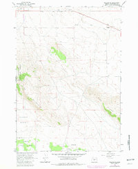
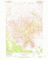
1966 Map of Millican SE
USGS Topo · Published 1981About this map
Pine Mountain dominates this high-desert landscape in central Oregon, where the volcanic terrain meets the eastern reaches of the Deschutes National Forest. The map documents a sparsely populated but active range, characterized by the winding course of the Dry River and the expansive Kotzman Basin. Infrastructure on the sheet reflects the practical needs of the mid-20th-century frontier, featuring a Landing Strip and the Radio Facility Antelope perched on high ground. Land use is largely defined by ranching and resource extraction, evidenced by several Corrals and a Borrow Pit. Small water sources such as Whitaker Holes and a solitary Well provide critical markers in an arid environment otherwise defined by its topographic ridges, including the prominent Pine Ridge to the southeast.
Find a feature on this map
15 named features on this map. Tap any name to fly to it.
Don’t see what you’re looking for? This feature index may not catch every label — zoom into the map to look around manually.
Map Details
Editions of this 1966 Millican SE Map
2 editions found
Other maps of this area

1955 · Crescent
USGS Topo · 1:250,000

1957 · Crescent
USGS Topo · 1:250,000

1958 · Crescent
USGS Topo · 1:250,000

1966 · Millican SE
USGS Topo · 1:24,000

1967 · Brothers NW
USGS Topo · 1:24,000
1967 · Brothers SW
USGS Topo · 1:24,000
1967 · West Butte
USGS Topo · 1:24,000
1967 · Millican
USGS Topo · 1:24,000
1967 · Pine Mountain
USGS Topo · 1:24,000

1970 · Crescent
USGS Topo · 1:250,000