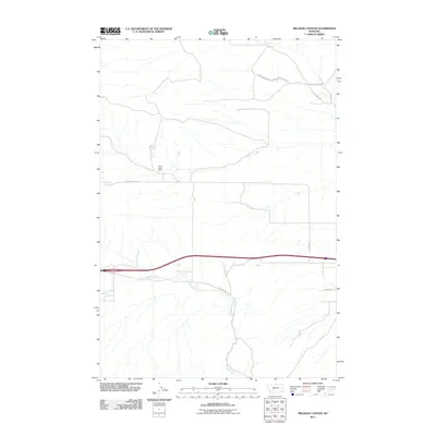
2011 Map of Milligan Canyon
USGS Topo · Published 2011About this map
Milligan Creek winds through this Jefferson County landscape, carving a drainage pattern that dictates the placement of rural ranching sites and local roads. The map highlights the Silver Sage Ranch as a primary settlement point, supported by water sources like Cowan Spring. The infrastructure here is defined by a network of winding valley roads, including Hidden Valley Rd and Bluebird Valley Rd, which navigate the elevation changes around Prospect Hill Rd. This survey documents a quiet stretch of Montana ranch land at a time when traditional pastoral footprints remained clearly visible alongside modern interstate thoroughfares. The relationship between the natural creek bed and the Milligan Canyon Rd corridor illustrates how the topography of the canyon continues to shape movement through this part of the state.
Find a feature on this map
12 named features on this map. Tap any name to fly to it.
Don’t see what you’re looking for? This feature index may not catch every label — zoom into the map to look around manually.
Map Details
Editions of this 2011 Milligan Canyon Map
This is the sole edition of this map. No revisions or reprints were ever made.
Other maps of this area

1886 · Fort Logan
USGS Topo · 1:250,000

1888 · Three Forks
USGS Topo · 1:250,000

1894 · Three Forks
USGS Topo · 1:250,000

1895 · Three Forks
USGS Topo · 1:250,000

1947 · Bozeman
USGS Topo · 1:250,000

1948 · Bozeman
USGS Topo · 1:250,000

1948 · White Sulphur Springs
USGS Topo · 1:250,000

1949 · Radersburg
USGS Topo · 1:62,500

1950 · Devils Fence
USGS Topo · 1:62,500

1950 · Three Forks
USGS Topo · 1:62,500