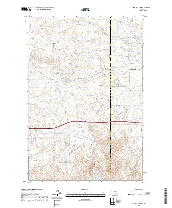
2024 Map of Milligan Canyon
USGS Topo · Published 2024About this map
Milligan Canyon carves a path through this part of the Montana landscape, where the high-altitude drainage of Milligan Creek meets a developing network of residential roads and historic corridors. The settlement of Wheatland sits in the northeastern corner, surrounded by a complex grid of modern loops and drives such as Wildrose Loop and Foxglove Loop, which contrast with the older overland routes like the Oregon Trl and Cherokee Trl. This area, split by the Jefferson and Broadwater county line, shows a transition from traditional ranching and mountain access toward rural residential expansion.
Find a feature on this map
40 named features on this map. Tap any name to fly to it.
Don’t see what you’re looking for? This feature index may not catch every label — zoom into the map to look around manually.
Map Details
Editions of this 2024 Milligan Canyon Map
This is the sole edition of this map. No revisions or reprints were ever made.
Other maps of this area

1886 · Fort Logan
USGS Topo · 1:250,000

1888 · Three Forks
USGS Topo · 1:250,000

1894 · Three Forks
USGS Topo · 1:250,000

1895 · Three Forks
USGS Topo · 1:250,000

1947 · Bozeman
USGS Topo · 1:250,000

1948 · Bozeman
USGS Topo · 1:250,000

1948 · White Sulphur Springs
USGS Topo · 1:250,000

1949 · Radersburg
USGS Topo · 1:62,500

1950 · Devils Fence
USGS Topo · 1:62,500

1950 · Three Forks
USGS Topo · 1:62,500