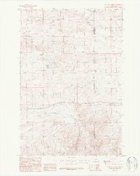
1987 Map of Milligan Canyon
USGS Topo · Published 1987About this map
Milligan Canyon carves through this portion of southwest Montana, where the high-altitude terrain is defined by water sources like Shoddy Springs and Cowan Spring. The settlement of Milligan and the nearby Silver Sage Ranch represent the sparse but resilient agricultural and ranching footprint in the late 20th century. The landscape is marked by the presence of Milligan Creek, which follows the canyon floor, and modern infrastructure like Trans Lines and Storage Bins that suggest a continued utility of the land for livestock and energy transport. Straddling the boundary of Jefferson and Broadwater Counties, the map illustrates a transition between cattle ranching outposts and the open, high plains characteristic of the region.
Find a feature on this map
10 named features on this map. Tap any name to fly to it.
Don’t see what you’re looking for? This feature index may not catch every label — zoom into the map to look around manually.
Map Details
Editions of this 1987 Milligan Canyon Map
This is the sole edition of this map. No revisions or reprints were ever made.
Other maps of this area

1886 · Fort Logan
USGS Topo · 1:250,000

1888 · Three Forks
USGS Topo · 1:250,000

1894 · Three Forks
USGS Topo · 1:250,000

1895 · Three Forks
USGS Topo · 1:250,000

1947 · Bozeman
USGS Topo · 1:250,000

1948 · Bozeman
USGS Topo · 1:250,000

1948 · White Sulphur Springs
USGS Topo · 1:250,000

1949 · Radersburg
USGS Topo · 1:62,500

1950 · Devils Fence
USGS Topo · 1:62,500

1950 · Three Forks
USGS Topo · 1:62,500