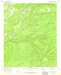
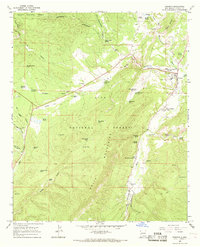
1965 Map of Milligan Mountain
USGS Topo · Published 1968About this map
Tularosa Mountains dominate this high-altitude landscape in the mid-1960s, defined by a complex network of canyons and mesas within the Gila National Forest. The hydrological importance of the area is evident in the many water sources serving the high country, including Kimball Spring, Largo Springs, and the Willow Spring at the foot of Willow Spring Mountain. These water points, along with various tanks like Dry Mesa Tank and Stump Tank, illustrate the essential infrastructure for ranching and forest management in this arid region.
Find a feature on this map
35 named features on this map. Tap any name to fly to it.
Don’t see what you’re looking for? This feature index may not catch every label — zoom into the map to look around manually.
Map Details
Editions of this 1965 Milligan Mountain Map
This is the sole edition of this map. No revisions or reprints were ever made.
Other maps of this area

1915 · Reserve
USGS Topo · 1:125,000

1918 · Reserve
USGS Topo · 1:125,000

1954 · Clifton
USGS Topo · 1:250,000

1957 · Clifton
USGS Topo · 1:250,000

1958 · Clifton
USGS Topo · 1:250,000

1962 · Clifton
USGS Topo · 1:250,000
1963 · Sign Camp Mountain
USGS Topo · 1:24,000
1963 · O Block Canyon
USGS Topo · 1:24,000
1963 · Telephone Canyon
USGS Topo · 1:24,000
1965 · Reserve
USGS Topo · 1:24,000