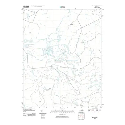
2010 Map of Millport
USGS Topo · Published 2010About this map
Pond River snakes through the center of this western Kentucky landscape, defining a terrain of wetlands and small tributaries like Isaacs Creek and Brier Creek. The map documents a predominantly rural infrastructure where small settlements such as Millport and Stringtown are connected by a network of local roads. Notable for genealogists, several family-named burial sites are present, including Salem Cemetery and Mercer Cemetery, often located near crossroads or at the ends of winding lanes like Mercer Cemetery Rd.
Find a feature on this map
36 named features on this map. Tap any name to fly to it.
Don’t see what you’re looking for? This feature index may not catch every label — zoom into the map to look around manually.
Map Details
Editions of this 2010 Millport Map
This is the sole edition of this map. No revisions or reprints were ever made.
Other maps of this area

1909 · Madisonville
USGS Topo · 1:62,500

1909 · Central City
USGS Topo · 1:62,500

1911 · Drakesboro
USGS Topo · 1:48,000

1912 · Nortonville
USGS Topo · 1:62,500

1913 · Drakesboro
USGS Topo · 1:62,500

1952 · Livermore
USGS Topo · 1:24,000

1952 · Sacramento
USGS Topo · 1:24,000

1952 · Greenville
USGS Topo · 1:24,000

1952 · Hanson
USGS Topo · 1:24,000

1953 · Nortonville
USGS Topo · 1:24,000