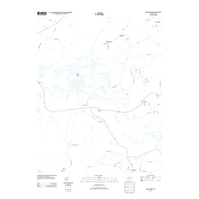
2013 Map of Millport
USGS Topo · Published 2013About this map
Millport sits at the northern edge of this Hopkins County landscape, where the meandering Pond River and Log Cr define the local drainage patterns. The 2013 survey illustrates a rural region marked by small clusters of settlement like Stringtown, Earles, and Sandy, connected by a network of local roads including Stringtown Rd and Vogue Haul Rd. This haul road and others like Crescent Haul Rd suggest the ongoing industrial or mining activity common to this part of Kentucky, contrasting with the natural terrain of Harpes Hill Valley and Harps Hill. Genealogists and local historians can pinpoint family-linked landmarks such as Mercer Cemetery Ln and several named branches, including Isaacs Cr and Harris Br, which provided the essential water sources for the early developments at Fies and Lynn City.
Find a feature on this map
57 named features on this map. Tap any name to fly to it.
Don’t see what you’re looking for? This feature index may not catch every label — zoom into the map to look around manually.
Map Details
Editions of this 2013 Millport Map
This is the sole edition of this map. No revisions or reprints were ever made.
Other maps of this area

1909 · Madisonville
USGS Topo · 1:62,500

1909 · Central City
USGS Topo · 1:62,500

1911 · Drakesboro
USGS Topo · 1:48,000

1912 · Nortonville
USGS Topo · 1:62,500

1913 · Drakesboro
USGS Topo · 1:62,500

1952 · Livermore
USGS Topo · 1:24,000

1952 · Sacramento
USGS Topo · 1:24,000

1952 · Greenville
USGS Topo · 1:24,000

1952 · Hanson
USGS Topo · 1:24,000

1953 · Nortonville
USGS Topo · 1:24,000