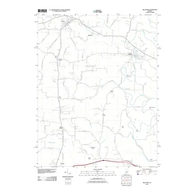
2010 Map of Milltown
USGS Topo · Published 2010About this map
Milltown sits at a prominent bend in the Blue River, a defining waterway that carves through the southern Indiana landscape. The river creates a sharp, narrow loop at The Narrows, while several creeks like Whiskey Run and Slick Run feed into the main channel from the surrounding hills. This survey documents a rural environment where small settlements like Marengo, Hogtown, and Carefree are connected by a network of winding roads, many following the natural contours of ridges like White Oak Ridge and Shafer Ridge.
Find a feature on this map
78 named features on this map. Tap any name to fly to it.
Don’t see what you’re looking for? This feature index may not catch every label — zoom into the map to look around manually.
Map Details
Editions of this 2010 Milltown Map
This is the sole edition of this map. No revisions or reprints were ever made.
Other maps of this area

1931 · Corydon
USGS Topo · 1:62,500

1944 · Corydon West
USGS Topo · 1:24,000

1946 · Leavenworth
USGS Topo · 1:24,000

1946 · Depauw
USGS Topo · 1:24,000

1947 · Leavenworth
USGS Topo · 1:24,000

1947 · Corydon West
USGS Topo · 1:24,000

1947 · Hardinsburg
USGS Topo · 1:24,000

1948 · Milltown
USGS Topo · 1:24,000

1949 · Hardinsburg
USGS Topo · 1:24,000

1950 · Beechwood
USGS Topo · 1:24,000