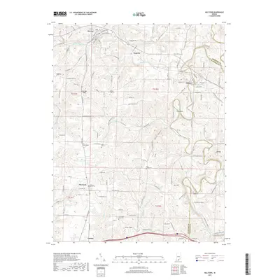
2019 Map of Milltown
USGS Topo · Published 2019About this map
The Blue River winds through the borderlands of Crawford and Harrison Counties, carving a deep valley that includes the dramatic horseshoe bend known as The Narrows. This landscape is defined by its karst-influenced topography, where high points like Pilot Knob and Buzzard Roost Hill overlook a network of tributary streams including Whiskey Run, Slick Run, and Brandywine Fork. The settlement pattern reflects the area's rural character, with the town of Milltown situated along the river and Marengo to the northwest.
Find a feature on this map
91 named features on this map. Tap any name to fly to it.
Don’t see what you’re looking for? This feature index may not catch every label — zoom into the map to look around manually.
Map Details
Editions of this 2019 Milltown Map
This is the sole edition of this map. No revisions or reprints were ever made.
Other maps of this area

1931 · Corydon
USGS Topo · 1:62,500

1944 · Corydon West
USGS Topo · 1:24,000

1946 · Leavenworth
USGS Topo · 1:24,000

1946 · Depauw
USGS Topo · 1:24,000

1947 · Leavenworth
USGS Topo · 1:24,000

1947 · Corydon West
USGS Topo · 1:24,000

1947 · Hardinsburg
USGS Topo · 1:24,000

1948 · Milltown
USGS Topo · 1:24,000

1949 · Hardinsburg
USGS Topo · 1:24,000

1950 · Beechwood
USGS Topo · 1:24,000