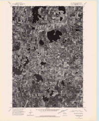
1974 Map of Milltown NE
USGS Topo · Published 1976About this map
This orthophotoquad reveals the intricate glaciated landscape of northwestern Wisconsin as it appeared in the mid-1970s. Unlike traditional topographic maps, this aerial imagery provides a direct visual record of the region's agricultural patterns and high density of kettle lakes and wetlands. The settlement of Atlas serves as a primary reference point in the southwestern portion of the sheet, situated within a patchwork of cleared farm fields and dense woodlots. The map illustrates how local transportation routes were dictated by the natural placement of numerous unnamed water bodies, creating a winding network of roads that connect the isolated farmsteads typical of the era.
Find a feature on this map
1 named feature on this map. Tap any name to fly to it.
Don’t see what you’re looking for? This feature index may not catch every label — zoom into the map to look around manually.
Map Details
Editions of this 1974 Milltown NE Map
This is the sole edition of this map. No revisions or reprints were ever made.
Other maps of this area

1950 · Webster
USGS Topo · 1:48,000

1950 · Grantsburg
USGS Topo · 1:48,000

1951 · Milltown
USGS Topo · 1:48,000

1951 · Frederic
USGS Topo · 1:48,000

1953 · Stillwater
USGS Topo · 1:250,000

1955 · Webster
USGS Topo · 1:62,500

1955 · Frederic
USGS Topo · 1:62,500

1955 · Milltown
USGS Topo · 1:62,500

1955 · Stillwater
USGS Topo · 1:250,000

1958 · Stillwater
USGS Topo · 1:250,000