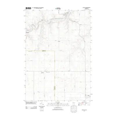
2013 Map of Millville
USGS Topo · Published 2013About this map
Millville and the winding Zumbro River dominate the northern landscape of this region, which straddles the boundary between Wabasha and Olmsted counties. The geography is defined by a series of small, dispersed settlements including Jarrett, Hammond, Bremen, and Potsdam. Local history is anchored by several rural burying grounds such as Swedish Lutheran Cem and Potsdam Lutheran Cem, which reflect the area's pioneer congregational heritage. Transport routes like Co HWY-11 and MN-247 connect these hamlets across a terrain carved by Silver Spring Cr, Long Cr, and Dry Cr. In the southeast, the town of Elgin marks a primary point of local commerce. The map illustrates a stable, rural township structure where land use is dictated by the river valleys and the traditional county line divisions.
Find a feature on this map
45 named features on this map. Tap any name to fly to it.
Don’t see what you’re looking for? This feature index may not catch every label — zoom into the map to look around manually.
Map Details
Editions of this 2013 Millville Map
This is the sole edition of this map. No revisions or reprints were ever made.
Other maps of this area

1932 · Wabasha
USGS Topo · 1:62,500

1934 · Plainview
USGS Topo · 1:62,500

1935 · Rochester
USGS Topo · 1:48,000

1938 · Plainview
USGS Topo · 1:62,500

1939 · Rochester
USGS Topo · 1:62,500

1951 · Wabasha
USGS Topo · 1:62,500

1951 · Lake City
USGS Topo · 1:62,500

1953 · Saint Paul
USGS Topo · 1:250,000

1959 · Saint Paul
USGS Topo · 1:250,000
1972 · Plainview
USGS Topo · 1:24,000