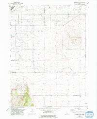
1965 Map of Milner Butte
USGS Topo · Published 1992About this map
Milner Butte anchors this high-desert landscape in Southern Idaho, representing a complex intersection of natural drainage and man-made irrigation infrastructure. During the mid-twentieth century, the expansion of agricultural systems is evident through the extensive Main Canal and its supporting Aqueduct and Pipeline networks. The Snake River basin's management is further documented by the Murtaugh Lake Spillway and a Diversion Dam located on Big Cottonwood Creek. Industrial and utility markers of the era include several Pumping Stations, the Lake Substation, and a Radio Tower. Geologic and economic activity is scattered across the township lines of Twin Falls and Cassia counties, evidenced by a Borrow Pit and numerous Gravel Pits used for local infrastructure development.
Find a feature on this map
24 named features on this map. Tap any name to fly to it.
Don’t see what you’re looking for? This feature index may not catch every label — zoom into the map to look around manually.
Map Details
Editions of this 1965 Milner Butte Map
2 editions found
Other maps of this area

1954 · Pocatello
USGS Topo · 1:250,000

1955 · Twin Falls
USGS Topo · 1:250,000

1958 · Twin Falls
USGS Topo · 1:250,000

1958 · Pocatello
USGS Topo · 1:250,000

1964 · Burley SW
USGS Topo · 1:24,000

1964 · Eden
USGS Topo · 1:24,000

1964 · Milner
USGS Topo · 1:24,000

1964 · Burley Butte
USGS Topo · 1:24,000

1965 · Rams Horn Ridge
USGS Topo · 1:24,000

1965 · Milner Butte
USGS Topo · 1:24,000