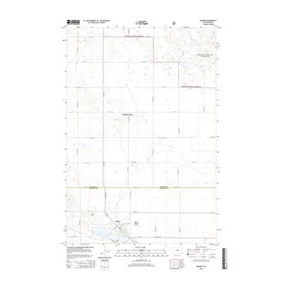
2014 Map of Milnor
USGS Topo · Published 2014About this map
Milnor sits at the intersection of local industry and the expansive prairie, anchored by its proximity to Storm Lake and the northern reaches of the Sheyenne National Grassland. The settlement layout is defined by the diagonal path of Main St and ND-13, which connect the town to the surrounding agricultural landscape of Sargent and Ransom counties. This 2014 survey reveals a community supporting diverse operations, from the northern Sundale Colony to the Milnor Municipal Airport on the eastern edge of town. For those researching local history, the map provides precise locations for both Lakeside Cem and Calvary Cem, marking the long-term presence of the community near the water's edge. The terrain is a network of section-line roads, such as 72nd St SE and 80th St SE, which grid the open plains and grassland areas.
Find a feature on this map
23 named features on this map. Tap any name to fly to it.
Don’t see what you’re looking for? This feature index may not catch every label — zoom into the map to look around manually.
Map Details
Editions of this 2014 Milnor Map
This is the sole edition of this map. No revisions or reprints were ever made.
Other maps of this area

1907 · Wyndmere
USGS Topo · 1:125,000

1953 · Fargo
USGS Topo · 1:250,000

1956 · Fargo
USGS Topo · 1:250,000

1958 · Cayuga NW
USGS Topo · 1:24,000

1958 · Hamlin
USGS Topo · 1:24,000

1960 · Lisbon SE
USGS Topo · 1:24,000

1960 · De Lamere
USGS Topo · 1:24,000

1960 · Lisbon NE
USGS Topo · 1:24,000

1960 · Venlo
USGS Topo · 1:24,000

1960 · Milnor
USGS Topo · 1:24,000