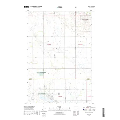
2017 Map of Milnor
USGS Topo · Published 2017About this map
The settlement of Milnor sits near the intersection of Old Hwy 13 and Co Rd 10, serving as a central hub for the surrounding agricultural prairie. To the west, the landscape is defined by the Storm Lake National Wildlife Refuge, which protects the waters of Storm Lake. The map illustrates a strictly organized section-line grid of roads, such as 141st Ave SE and 79th St SE, that divide the fertile landscape between Ransom and Sargent counties. Conservation areas are prominent throughout this region, including the Ransom County Waterfowl Production Area and the southern reaches of the Sheyenne National Grassland. Local heritage is preserved at Lakeside Cem near the small community of Lakeside and at Calvary Cem further north, providing key points of interest for genealogists and local historians studying the rural development of this North Dakota borderland.
Find a feature on this map
46 named features on this map. Tap any name to fly to it.
Don’t see what you’re looking for? This feature index may not catch every label — zoom into the map to look around manually.
Map Details
Editions of this 2017 Milnor Map
This is the sole edition of this map. No revisions or reprints were ever made.
Other maps of this area

1907 · Wyndmere
USGS Topo · 1:125,000

1953 · Fargo
USGS Topo · 1:250,000

1956 · Fargo
USGS Topo · 1:250,000

1958 · Cayuga NW
USGS Topo · 1:24,000

1958 · Hamlin
USGS Topo · 1:24,000

1960 · Lisbon SE
USGS Topo · 1:24,000

1960 · De Lamere
USGS Topo · 1:24,000

1960 · Lisbon NE
USGS Topo · 1:24,000

1960 · Venlo
USGS Topo · 1:24,000

1960 · Milnor
USGS Topo · 1:24,000