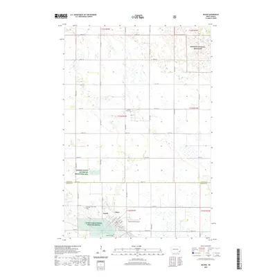
2020 Map of Milnor
USGS Topo · Published 2020About this map
Milnor anchors the landscape where the agricultural plains of the Red River Valley transition toward the prairie potholes of southeastern North Dakota. The settlement is defined by its traditional grid, featuring streets like Old Hwy 13 and 1st St, and is flanked by several significant burial grounds, including Lakeside Cem and the Milnor Calvary Cem Lutheran Cem. Outside the town center, the terrain is shaped by conservation efforts and glacial remnants, notably the Storm Lake National Wildlife Refuge and the southern reaches of the Sheyenne National Grassland. The presence of the Sundale Colony Cem to the north and the Ransom County Waterfowl Production Area suggests a region where communal farming traditions and migratory bird habitats coexist along the Ransom and Sargent county lines.
Find a feature on this map
35 named features on this map. Tap any name to fly to it.
Don’t see what you’re looking for? This feature index may not catch every label — zoom into the map to look around manually.
Map Details
Editions of this 2020 Milnor Map
This is the sole edition of this map. No revisions or reprints were ever made.
Other maps of this area

1907 · Wyndmere
USGS Topo · 1:125,000

1953 · Fargo
USGS Topo · 1:250,000

1956 · Fargo
USGS Topo · 1:250,000

1958 · Cayuga NW
USGS Topo · 1:24,000

1958 · Hamlin
USGS Topo · 1:24,000

1960 · Lisbon SE
USGS Topo · 1:24,000

1960 · De Lamere
USGS Topo · 1:24,000

1960 · Lisbon NE
USGS Topo · 1:24,000

1960 · Venlo
USGS Topo · 1:24,000

1960 · Milnor
USGS Topo · 1:24,000