2024 Map of Milnor
USGS Topo · Published 2024About this map
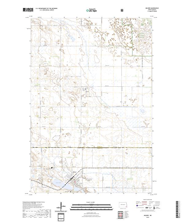
Milnor serves as the primary hub of this landscape at the border of Ransom and Sargent counties, where the grid of sectional roads like 141st Ave SE meets the residential streets of the town center. The surrounding terrain is characterized by a high density of small wetlands and depressions, integrated into conservation lands such as the Sheyenne National Grassland and the Ransom County Waterfowl Production Area. To the southwest of the main settlement, Storm Lake is protected within the Storm Lake National Wildlife Refuge. Local history and genealogy are anchored by several established burial grounds, including Milnor Lutheran Cem, Calvary Cem, and Lakeside Cem, while the northern portion of the map identifies the Sundale Colony Cem. Transport in the area relies on the local connection of Old Hwy 13 and the nearby Milnor Municipal Airport.
Find a feature on this map
42 named features on this map. Tap any name to fly to it.
Don’t see what you’re looking for? This feature index may not catch every label — zoom into the map to look around manually.
Map Details
Editions of this 2024 Milnor Map
This is the sole edition of this map. No revisions or reprints were ever made.