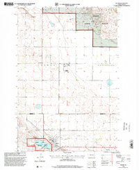
1998 Map of Milnor
USGS Topo · Published 2000About this map
The Soo Line railroad bisects the prairie landscape as it passes through the town of Milnor, a vital hub in this agricultural region during the late 20th century. The map illustrates a transition from the structured township grids of Sydnoa and Rosemeade to the preserved environments of the Storm Lake National Wildlife Refuge and the southern edge of the Sheyenne National Grassland. These conservation areas around Storm Lake provide a stark contrast to the surrounding section lines and gravel operations.
Find a feature on this map
23 named features on this map. Tap any name to fly to it.
Don’t see what you’re looking for? This feature index may not catch every label — zoom into the map to look around manually.
Map Details
Editions of this 1998 Milnor Map
This is the sole edition of this map. No revisions or reprints were ever made.
Other maps of this area

1907 · Wyndmere
USGS Topo · 1:125,000

1953 · Fargo
USGS Topo · 1:250,000

1956 · Fargo
USGS Topo · 1:250,000

1958 · Cayuga NW
USGS Topo · 1:24,000

1958 · Hamlin
USGS Topo · 1:24,000

1960 · Lisbon SE
USGS Topo · 1:24,000

1960 · De Lamere
USGS Topo · 1:24,000

1960 · Lisbon NE
USGS Topo · 1:24,000

1960 · Venlo
USGS Topo · 1:24,000

1960 · Milnor
USGS Topo · 1:24,000