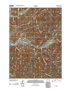
2011 Map of Milo
USGS Topo · Published 2011About this map
The South Umpqua River carves a central path through this Douglas County landscape, serving as the primary corridor for settlement and transit. Along its banks, the community of Milo sits near the confluence with Stouts Creek, while further west, the Riverview Ranch Airport and Lavadoure Community Hall serve as local hubs. The terrain is defined by a dense network of drainages and ridges, including Bland Mountain and O'Neill Butte, interspersed with small hollows like Doe Hollow. Extensive Bureau of Land Management routes, such as BLM 16 0 Rd and BLM 31 Rd, weave through the uplands, reflecting the importance of timber and land management in this region. For those tracing local heritage, the Lavadoure Cemetery and family-named landmarks like Bailey Gulch provide specific points of historical interest within the rugged topography of the Umpqua National Forest vicinity.
Find a feature on this map
51 named features on this map. Tap any name to fly to it.
Don’t see what you’re looking for? This feature index may not catch every label — zoom into the map to look around manually.
Map Details
Editions of this 2011 Milo Map
This is the sole edition of this map. No revisions or reprints were ever made.
Other maps of this area

1891 · Ashland
USGS Topo · 1:250,000

1893 · Ashland
USGS Topo · 1:250,000

1897 · Roseburg
USGS Topo · 1:125,000

1897 · Ashland
USGS Topo · 1:250,000

1900 · Roseburg
USGS Topo · 1:125,000

1904 · Riddle
USGS Topo · 1:125,000

1944 · Tiller
USGS Topo · 1:62,500

1954 · Dixonville
USGS Topo · 1:62,500

1954 · Days Creek
USGS Topo · 1:62,500

1955 · Red Butte
USGS Topo · 1:62,500