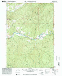
1998 Map of Milo
USGS Topo · Published 2000About this map
Milo and the nearby Milo Academy anchor this mountainous section of Douglas County, where the South Fork Umpqua River carves a deep valley through the Umpqua National Forest. The landscape is defined by rugged elevation changes, rising from the riverbanks to the heights of Bland Mountain and O'Neill Butte. Transportation in this remote corridor relies on a network of forest roads and unique river crossings, including a Covered Bridge and a Footbridge. A small Landing Strip and a roadside Wayside indicate the region's role as a waypoint for travelers and forest workers alike. Genealogists and local historians will find the small Cem particularly noteworthy, while the numerous drainages like Days Creek, Lavadoure Creek, and St John Creek illustrate the complex watershed that feeds the Umpqua. The map reflects a moment in the late 20th century when forest management and small-scale settlement remained the primary human imprints on the land.
Find a feature on this map
26 named features on this map. Tap any name to fly to it.
Don’t see what you’re looking for? This feature index may not catch every label — zoom into the map to look around manually.
Map Details
Editions of this 1998 Milo Map
This is the sole edition of this map. No revisions or reprints were ever made.
Other maps of this area

1891 · Ashland
USGS Topo · 1:250,000

1893 · Ashland
USGS Topo · 1:250,000

1897 · Roseburg
USGS Topo · 1:125,000

1897 · Ashland
USGS Topo · 1:250,000

1900 · Roseburg
USGS Topo · 1:125,000

1904 · Riddle
USGS Topo · 1:125,000

1944 · Tiller
USGS Topo · 1:62,500

1954 · Dixonville
USGS Topo · 1:62,500

1954 · Days Creek
USGS Topo · 1:62,500

1955 · Red Butte
USGS Topo · 1:62,500