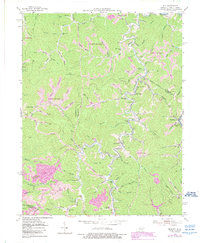
1954 Map of Milo
USGS Topo · Published 1989About this map
Tug Fork defines the northeastern boundary of this survey, carving a deep valley that separates Kentucky from West Virginia. The landscape is characterized by its complex drainage network, where Rockcastle Creek and its many tributaries, such as Wolfpen Branch and Prater Branch, have etched a dense pattern of ridges and hollows. This area of Martin County shows a distinct settlement pattern focused on these narrow valley floors, with small communities like Milo and Clifford established near the water.
Find a feature on this map
95 named features on this map. Tap any name to fly to it.
Don’t see what you’re looking for? This feature index may not catch every label — zoom into the map to look around manually.
Map Details
Editions of this 1954 Milo Map
4 editions found
Other maps of this area

1886 · Prestonsburg
USGS Topo · 1:125,000

1887 · Warfield
USGS Topo · 1:125,000

1891 · Warfield
USGS Topo · 1:125,000

1892 · Prestonsburg
USGS Topo · 1:125,000

1892 · Huntington
USGS Topo · 1:125,000

1898 · Huntington
USGS Topo · 1:125,000

1903 · Kenova
USGS Topo · 1:125,000

1904 · Kenova
USGS Topo · 1:125,000

1909 · Wayne
USGS Topo · 1:62,500

1910 · Naugatuck
USGS Topo · 1:48,000