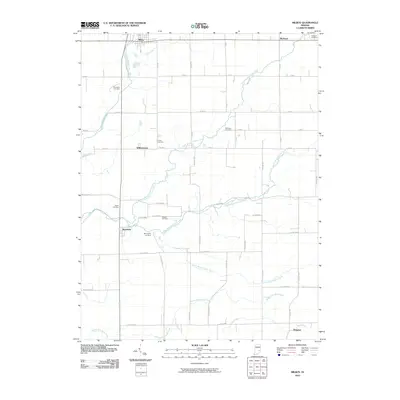
2010 Map of Milroy
USGS Topo · Published 2010About this map
Milroy and Richland anchor the northern reaches of this rural landscape, where the agricultural grid of Rush County is shaped by a dense network of watercourses. The drainage of the area is defined by the branching paths of North Branch Clifty Creek, Middle Branch Clifty Creek, and South Branch Clifty Creek, which converge and wind toward the southwest. These creek beds and the Little Flatrock River offer a topographical contrast to the straight-line precision of the county road system.
Find a feature on this map
55 named features on this map. Tap any name to fly to it.
Don’t see what you’re looking for? This feature index may not catch every label — zoom into the map to look around manually.
Map Details
Editions of this 2010 Milroy Map
This is the sole edition of this map. No revisions or reprints were ever made.
Other maps of this area

1942 · Columbus
USGS Topo · 1:125,000

1946 · New Point
USGS Topo · 1:24,000

1953 · Cincinnati
USGS Topo · 1:250,000

1957 · Cincinnati
USGS Topo · 1:250,000

1958 · Greensburg
USGS Topo · 1:24,000

1958 · Forest Hill
USGS Topo · 1:24,000

1958 · Clarksburg
USGS Topo · 1:24,000

1959 · Milroy
USGS Topo · 1:24,000

1959 · Rushville
USGS Topo · 1:24,000

1959 · New Salem
USGS Topo · 1:24,000