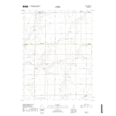
2019 Map of Milroy
USGS Topo · Published 2019About this map
Milroy and Richland anchor the northern landscape of this agricultural region in eastern Indiana, where the terrain is defined by the branching waters of Clifty Creek. The area exhibits a classic midwestern section-line road grid, with many routes still designated by their coordinate positions like E 900 S or S Base Rd. Small crossroad communities such as Williamstown and Sandusky appear alongside a high density of burial grounds, including the Old Richland Methodist Cem and the Overleese Cem. These cemeteries, often tucked near creek bends or along section lines, provide a clear genealogical record of the families who established the homesteads in Rush and Decatur counties. To the south, Kingston sits near the headwaters of Muddy Fork Sand Cr, illustrating how early settlements were positioned in proximity to both the drainage network and the developing county road system.
Find a feature on this map
70 named features on this map. Tap any name to fly to it.
Don’t see what you’re looking for? This feature index may not catch every label — zoom into the map to look around manually.
Map Details
Editions of this 2019 Milroy Map
This is the sole edition of this map. No revisions or reprints were ever made.
Other maps of this area

1942 · Columbus
USGS Topo · 1:125,000

1946 · New Point
USGS Topo · 1:24,000

1953 · Cincinnati
USGS Topo · 1:250,000

1957 · Cincinnati
USGS Topo · 1:250,000

1958 · Greensburg
USGS Topo · 1:24,000

1958 · Forest Hill
USGS Topo · 1:24,000

1958 · Clarksburg
USGS Topo · 1:24,000

1959 · Milroy
USGS Topo · 1:24,000

1959 · Rushville
USGS Topo · 1:24,000

1959 · New Salem
USGS Topo · 1:24,000