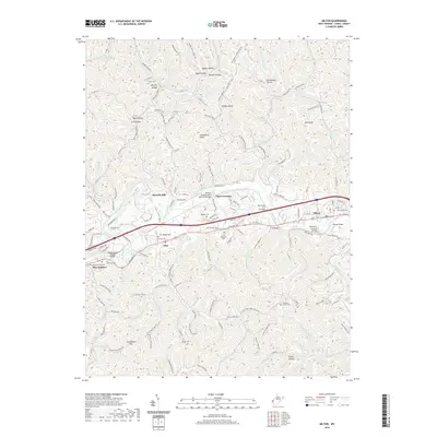
2019 Map of Milton
USGS Topo · Published 2019About this map
Milton sits at the heart of this Cabell County landscape, where the Mud River carves a winding path through the hills of West Virginia. The infrastructure reflects a blend of historic transportation and modern corridors, featuring the iconic Mud River Covered Bridge alongside contemporary spans like the Blenko Bridge and the William Bradley Fulks Memorial Bridge. The river's influence is evident in the cluster of small settlements and crossings that line its banks, including Yates Crossing, Howells Mill, and Ona.
Find a feature on this map
158 named features on this map. Tap any name to fly to it.
Don’t see what you’re looking for? This feature index may not catch every label — zoom into the map to look around manually.
Map Details
Editions of this 2019 Milton Map
This is the sole edition of this map. No revisions or reprints were ever made.
Other maps of this area

1892 · Huntington
USGS Topo · 1:125,000

1898 · Huntington
USGS Topo · 1:125,000

1901 · Guyandot
USGS Topo · 1:62,500

1902 · Guyandot
USGS Topo · 1:62,500

1902 · Milton
USGS Topo · 1:62,500

1906 · Athalia
USGS Topo · 1:62,500

1906 · Glenwood
USGS Topo · 1:62,500

1908 · Athalia
USGS Topo · 1:62,500

1908 · Glenwood
USGS Topo · 1:62,500

1931 · Milton
USGS Topo · 1:62,500