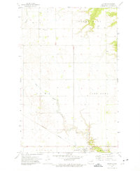
1972 Map of Milton
USGS Topo · Published 1975About this map
The settlement of Milton serves as the focal point of this northeastern North Dakota landscape, situated along the Burlington Northern railroad line in the early 1970s. This agricultural region is defined by its rural townships, including South Olga, Alma, and Montrose, where the sectioned prairie is dotted with sites of local heritage. The map records several spiritual landmarks such as North Dovre Ch, Fjalla Ch, and the St Clothilda Cem, providing valuable location data for genealogical research.
Find a feature on this map
23 named features on this map. Tap any name to fly to it.
Don’t see what you’re looking for? This feature index may not catch every label — zoom into the map to look around manually.
Map Details
Editions of this 1972 Milton Map
This is the sole edition of this map. No revisions or reprints were ever made.
Other maps of this area

1918 · Walhalla
USGS Topo · 1:62,500

1943 · Walhalla
USGS Topo · 1:62,500

1952 · Thief River Falls
USGS Topo · 1:250,000

1953 · Devils Lake
USGS Topo · 1:250,000

1956 · Thief River Falls
USGS Topo · 1:250,000

1956 · Devils Lake
USGS Topo · 1:250,000

1957 · Thief River Falls
USGS Topo · 1:250,000
1964 · Concrete
USGS Topo · 1:24,000
1964 · Hanks Corner
USGS Topo · 1:24,000

1967 · Thief River Falls
USGS Topo · 1:250,000