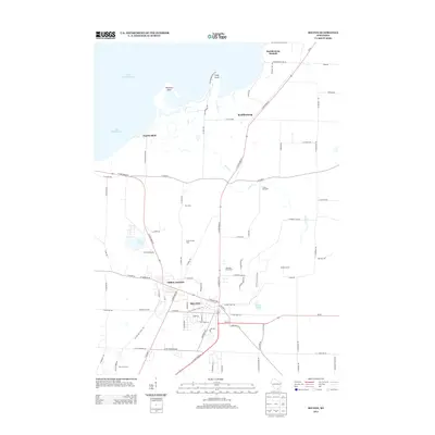
2013 Map of Milton
USGS Topo · Published 2013About this map
Milton and the neighboring community of Milton Junction serve as the primary population centers in this portion of Rock County, where the agricultural plains transition into the recreational shoreline of Lake Koshkonong. The landscape is a mix of established farmland and developed lakeside points, including Charlie Bluff, Thiebeau Point, and Stony Point. Several agricultural operations such as Clean Sweep Farm, Bellaire Farms, and Riesterer Farms are clearly marked, illustrating the area's continued reliance on the land. To the north, the presence of Koshkonong Mounds and the Koshkonong settlement indicates a long history of human occupation near the water. The map also captures local recreation and education sites like Camp Wakonda and the Oakridge Golf Course, situated among natural water bodies like Storrs Lake and Clear Lake.
Find a feature on this map
90 named features on this map. Tap any name to fly to it.
Don’t see what you’re looking for? This feature index may not catch every label — zoom into the map to look around manually.
Map Details
Editions of this 2013 Milton Map
This is the sole edition of this map. No revisions or reprints were ever made.
Other maps of this area

1890 · Stoughton
USGS Topo · 1:62,500

1891 · Koshkonong
USGS Topo · 1:62,500

1891 · Janesville
USGS Topo · 1:62,500

1893 · Janesville
USGS Topo · 1:62,500

1893 · Shopiere
USGS Topo · 1:62,500

1894 · Koshkonong
USGS Topo · 1:62,500

1906 · Koshkonong
USGS Topo · 1:62,500

1954 · Rockford
USGS Topo · 1:250,000

1955 · Rockford
USGS Topo · 1:250,000

1958 · Rockford
USGS Topo · 1:250,000