2022 Map of Milton
USGS Topo · Published 2022About this map
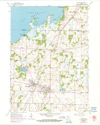
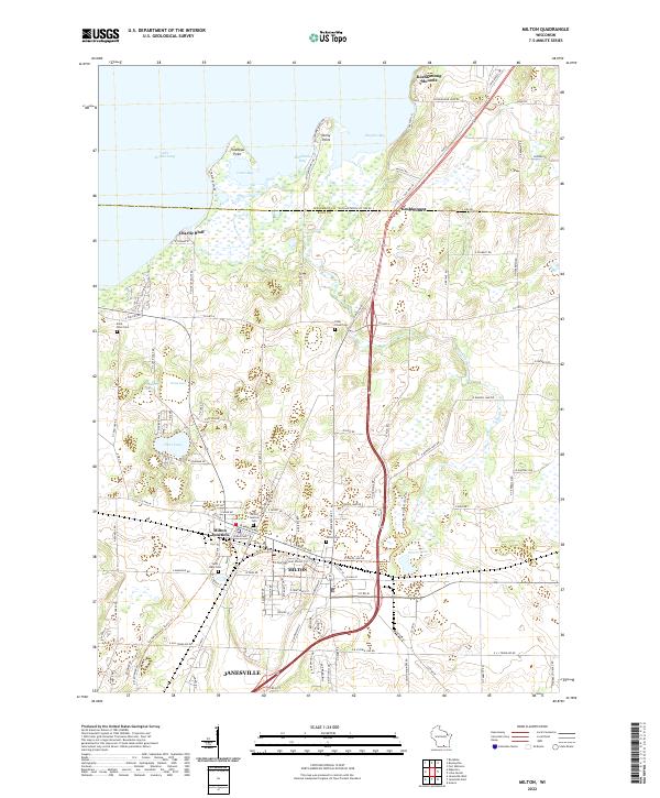
Milton and the neighboring community of Milton Junction anchor this study of south-central Wisconsin's landscape as it appeared in the early 21st century. The map highlights a region where agricultural land meets the expanding residential footprints of nearby Janesville and the shores of Lake Koshkonong. Notable for local historians and genealogists are several established burial grounds, including the Rock River Cem, Saint Mary Cem, and the Otter Creek Cem, which sit alongside historic points of interest like the Koshkonong Mounds. The shoreline of the lake is punctuated by landmarks such as Charlie Bluff and Thiebeau Point, while the interior terrain is defined by glacial features like Cranberry Marsh, Clear Lake, and Grass Lake. This record captures the transition from open wetlands and farming tracts to the modern transport corridors of Old 26 and the newer highway system.
Find a feature on this map
119 named features on this map. Tap any name to fly to it.
Don’t see what you’re looking for? This feature index may not catch every label — zoom into the map to look around manually.
Map Details
Editions of this 2022 Milton Map
This is the sole edition of this map. No revisions or reprints were ever made.