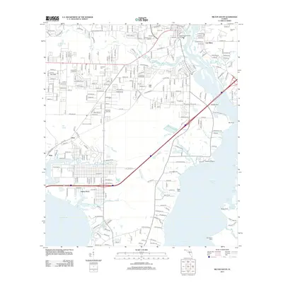
2012 Map of Milton South
USGS Topo · Published 2012About this map
Avalon Beach and the surrounding coastal communities in Santa Rosa County sit at the confluence of several major Florida waterways, including Escambia Bay and Blackwater Bay. The landscape is defined by its intricate shoreline, where Whiteoak Bayou, Indian Bayou, and Jakes Bayou carve into the mainland, separating local settlements like Mulat and Harp. Further north, the Blackwater River passes through East Milton near the Pensacola Community College campus, reflecting the area's role as an educational and residential hub. This 2012 survey captures the modern infrastructure of the region, including the Mulat Lookout Tower and the suburban growth around Pea Ridge and Galt City. Family historians will find interest in the documented locations of several local burial grounds, such as Magnolia Cem, Strickland Cem, and Milton Cem, which remain as anchored points of heritage amid the shifting bayous and expanding road networks.
Find a feature on this map
270 named features on this map. Tap any name to fly to it.
Don’t see what you’re looking for? This feature index may not catch every label — zoom into the map to look around manually.
Map Details
Editions of this 2012 Milton South Map
This is the sole edition of this map. No revisions or reprints were ever made.
Other maps of this area

1920 · Milton
USGS Topo · 1:62,500

1921 · Holley
USGS Topo · 1:62,500

1921 · Pensacola
USGS Topo · 1:62,500

1934 · Harold
USGS Topo · 1:62,500

1936 · Holley
USGS Topo · 1:48,000

1937 · Harold
USGS Topo · 1:62,500

1938 · Holley
USGS Topo · 1:62,500

1938 · Harold
USGS Topo · 1:62,500

1941 · Pensacola
USGS Topo · 1:62,500

1941 · Milton
USGS Topo · 1:62,500