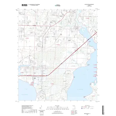
2018 Map of Milton South
USGS Topo · Published 2018About this map
Bagdad and the southern reaches of Milton anchor this survey of the Florida panhandle's coastline, where the Blackwater River feeds into Blackwater Bay. The map documents a landscape defined by its intricate waterways, from the broad expanse of Escambia Bay to the marshy fingers of Whiteoak Bayou and Indian Bayou. Residential growth is evident in settlements like Pea Ridge, Harp, and Avalon Beach, while the northern section includes institutional landmarks such as the Pensacola State College - Milton Campus. The region's geography is dominated by coastal points and basins, including Shields Point and the Doghole Basin, illustrating the transition from upland communities to the brackish wetlands of the Gulf of Mexico. Local history is preserved in the location of the Strickland Cem and Magnolia Cem.
Find a feature on this map
48 named features on this map. Tap any name to fly to it.
Don’t see what you’re looking for? This feature index may not catch every label — zoom into the map to look around manually.
Map Details
Editions of this 2018 Milton South Map
This is the sole edition of this map. No revisions or reprints were ever made.
Other maps of this area

1920 · Milton
USGS Topo · 1:62,500

1921 · Holley
USGS Topo · 1:62,500

1921 · Pensacola
USGS Topo · 1:62,500

1934 · Harold
USGS Topo · 1:62,500

1936 · Holley
USGS Topo · 1:48,000

1937 · Harold
USGS Topo · 1:62,500

1938 · Holley
USGS Topo · 1:62,500

1938 · Harold
USGS Topo · 1:62,500

1941 · Pensacola
USGS Topo · 1:62,500

1941 · Milton
USGS Topo · 1:62,500