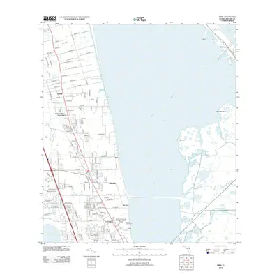
2012 Map of Mims
USGS Topo · Published 2012About this map
The Indian River serves as the dominant geographical feature of this coastal Florida landscape, separating the residential corridors of the mainland from the intricate wetlands to the east. The primary settlements of East Mims and La Grange anchor the southern half of the map, while the northern reaches include the community of Turnbull and the recreational Holiday Village Travel Park. Education and transportation are well-defined here, featuring the Brevard Community College - Titusville Campus and the Arthur Dunn Air Park situated near South Lake.
Find a feature on this map
149 named features on this map. Tap any name to fly to it.
Don’t see what you’re looking for? This feature index may not catch every label — zoom into the map to look around manually.
Map Details
Editions of this 2012 Mims Map
This is the sole edition of this map. No revisions or reprints were ever made.
Other maps of this area

1949 · Oak Hill
USGS Topo · 1:24,000

1949 · Pardon Island
USGS Topo · 1:24,000

1949 · Orsino
USGS Topo · 1:24,000

1949 · Titusville
USGS Topo · 1:24,000

1949 · Wilson
USGS Topo · 1:24,000

1949 · Mims
USGS Topo · 1:24,000

1950 · Maytown
USGS Topo · 1:24,000

1950 · Aurantia
USGS Topo · 1:24,000

1951 · Orsino
USGS Topo · 1:24,000

1952 · Mims
USGS Topo · 1:24,000