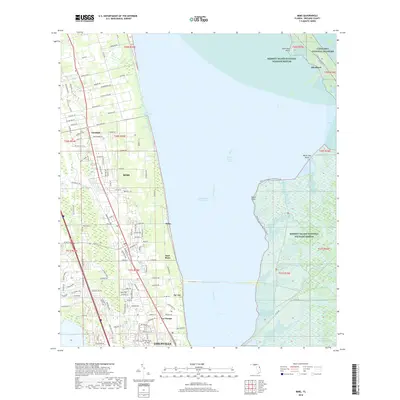
2018 Map of Mims
USGS Topo · Published 2018About this map
Mims and the northern reaches of Titusville anchor this coastal landscape along the Indian River Lagoon. The map illustrates a complex coastal environment where residential development meets significant protected lands. On the mainland, smaller settlements like La Grange, Wiley, and Jay Jay are established along a network of local roads and thoroughfares like Aurantia Rd. To the west of the urban corridor, Arthur Dunn Air Park serves as a local aviation landmark.
Find a feature on this map
119 named features on this map. Tap any name to fly to it.
Don’t see what you’re looking for? This feature index may not catch every label — zoom into the map to look around manually.
Map Details
Editions of this 2018 Mims Map
This is the sole edition of this map. No revisions or reprints were ever made.
Other maps of this area

1949 · Oak Hill
USGS Topo · 1:24,000

1949 · Pardon Island
USGS Topo · 1:24,000

1949 · Orsino
USGS Topo · 1:24,000

1949 · Titusville
USGS Topo · 1:24,000

1949 · Wilson
USGS Topo · 1:24,000

1949 · Mims
USGS Topo · 1:24,000

1950 · Maytown
USGS Topo · 1:24,000

1950 · Aurantia
USGS Topo · 1:24,000

1951 · Orsino
USGS Topo · 1:24,000

1952 · Mims
USGS Topo · 1:24,000