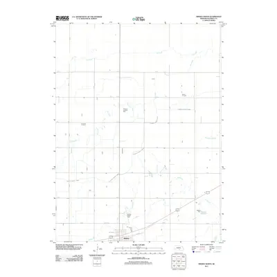
2011 Map of Minden North
USGS Topo · Published 2011About this map
Minden anchors the southern edge of this Kearney County landscape, where the structured grid of rural roads meets a complex network of Nebraska prairie waterways. The map illustrates a transitional zone between agriculture and regional infrastructure, marked prominently by the Phelps County Canal as it cuts across the township. Local heritage is preserved in the placement of Liberty Cemetery and White Hill Cemetery, while the aviation and cultural history of the area is represented by the Newbold Landing Strip and Pioneer Village Field. Water management is a defining theme of the region, visible through the seasonal paths of Lost Creek and Dry Creek, alongside the engineered Nielsen Reservoir held by the Nielsen Dam. This 2011 survey captures the enduring rural character of the Platte River valley hinterlands, showing how legacy farm properties and modern water resources coexist.
Find a feature on this map
22 named features on this map. Tap any name to fly to it.
Don’t see what you’re looking for? This feature index may not catch every label — zoom into the map to look around manually.
Map Details
Editions of this 2011 Minden North Map
This is the sole edition of this map. No revisions or reprints were ever made.
Other maps of this area

1894 · Kearney
USGS Topo · 1:62,500

1894 · Minden
USGS Topo · 1:62,500

1896 · Holdrege
USGS Topo · 1:125,000

1896 · Kearney
USGS Topo · 1:125,000

1896 · Wood River
USGS Topo · 1:125,000

1897 · Red Cloud
USGS Topo · 1:125,000

1955 · Grand Island
USGS Topo · 1:250,000

1957 · Grand Island
USGS Topo · 1:250,000

1958 · Grand Island
USGS Topo · 1:250,000

1962 · Newark
USGS Topo · 1:24,000