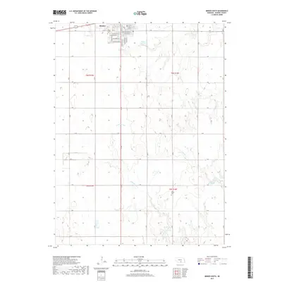
2017 Map of Minden South
USGS Topo · Published 2017About this map
Minden anchors the northern edge of this Kearney County landscape, where the grid of residential streets like W Holland St and S Minden Ave transitions abruptly into the agricultural section lines of the Nebraska plains. The area is defined by the winding course of the Little Blue River, which meanders southeast toward the Free Mission Cemetery. Water management is central to this prairie environment, evidenced by the presence of Hubert Reservoir and Warp Reservoir, alongside the drainage of S Br Sand Cr. For those tracing local heritage, the map identifies the Minden Prairie Cemetery situated just south of the town center. The underlying structure of the 2010s reveals a region where traditional section-line roads, such as K Rd and 32 Rd, maintain a rigid geometric order over the shifting hydrology of the river basin.
Find a feature on this map
41 named features on this map. Tap any name to fly to it.
Don’t see what you’re looking for? This feature index may not catch every label — zoom into the map to look around manually.
Map Details
Editions of this 2017 Minden South Map
This is the sole edition of this map. No revisions or reprints were ever made.
Other maps of this area

1894 · Kearney
USGS Topo · 1:62,500

1894 · Minden
USGS Topo · 1:62,500

1896 · Holdrege
USGS Topo · 1:125,000

1896 · Kearney
USGS Topo · 1:125,000

1896 · Wood River
USGS Topo · 1:125,000

1897 · Red Cloud
USGS Topo · 1:125,000

1955 · Grand Island
USGS Topo · 1:250,000

1957 · Grand Island
USGS Topo · 1:250,000

1958 · Grand Island
USGS Topo · 1:250,000

1969 · Upland
USGS Topo · 1:24,000