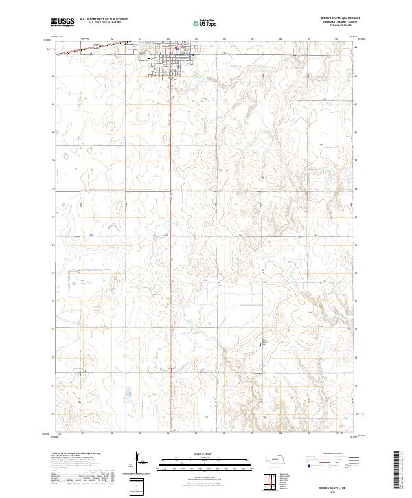
2021 Map of Minden South
USGS Topo · Published 2021About this map
Minden anchors the northern edge of this Kearney County landscape, where the Kearney County Courthouse and a grid of residential streets like E 4th St and S Colorado Ave give way to the agricultural expanse of south-central Nebraska. The transition from town to country is marked by the Minden Cem, while further south, the Free Mission Cem remains a quiet landmark among the section lines. The drainage of the Little Blue River and S Br Sand Cr carves subtle relief into the terrain, feeding into local impoundments such as Hubert Reservoir and Warp Reservoir. This survey captures the highly structured rural economy, defined by a rigid network of lettered and numbered roads that facilitate access across the plains.
Find a feature on this map
40 named features on this map. Tap any name to fly to it.
Don’t see what you’re looking for? This feature index may not catch every label — zoom into the map to look around manually.
Map Details
Editions of this 2021 Minden South Map
This is the sole edition of this map. No revisions or reprints were ever made.
Other maps of this area

1894 · Kearney
USGS Topo · 1:62,500

1894 · Minden
USGS Topo · 1:62,500

1896 · Holdrege
USGS Topo · 1:125,000

1896 · Kearney
USGS Topo · 1:125,000

1896 · Wood River
USGS Topo · 1:125,000

1897 · Red Cloud
USGS Topo · 1:125,000

1955 · Grand Island
USGS Topo · 1:250,000

1957 · Grand Island
USGS Topo · 1:250,000

1958 · Grand Island
USGS Topo · 1:250,000

1969 · Upland
USGS Topo · 1:24,000